The Hairy giraffe… IN CHILE
Chile is a very long country, so we had to make choices — it was impossible to see everything in just two weeks. Our decisions were mostly based on the season and climate. We arrived during the Chilean winter, and the central and southern regions are typically better visited during the austral summer, when the weather is milder. That’s why we chose to visit Easter Island and the Atacama Desert.
Here’s everything you need to know about this trip!
How long? We spent 2 weeks in Chile, including 5 days on Easter Island.
When? Mid-July, it’s winter in Chile. The weather is quite chilly in Santiago. In Atacama, when the sun is out, temperatures reach around 20°C, but the sun is very intense, so a hat and sunscreen are a must. However, as soon as the sun sets, the temperature drops sharply and it gets cold.
Ease of independent travel: 5 giraffes ![]() With efficient public transport in Santiago, rental cars readily available in the north, and flights connecting the country’s major cities, getting around Chile is fairly easy. In San Pedro, agencies are everywhere, so you won’t have any trouble visiting the various sites — as long as you’re willing to open your wallet wide.
With efficient public transport in Santiago, rental cars readily available in the north, and flights connecting the country’s major cities, getting around Chile is fairly easy. In San Pedro, agencies are everywhere, so you won’t have any trouble visiting the various sites — as long as you’re willing to open your wallet wide.
Costs: 5 giraffes ![]() Chile is an expensive country to visit. Food, fuel, and tourist sites all come at a high cost. Visiting the natural attractions in the Atacama Desert is pricey expect to pay several dozen euros per site per person if you go with an organized tour. Traveling by car will save you some money, but you’ll still need to pay a few euros at the entrance of each site.
Chile is an expensive country to visit. Food, fuel, and tourist sites all come at a high cost. Visiting the natural attractions in the Atacama Desert is pricey expect to pay several dozen euros per site per person if you go with an organized tour. Traveling by car will save you some money, but you’ll still need to pay a few euros at the entrance of each site.
Be aware that in many places across the country, you’re asked to pay in U.S. dollars this is especially common in hotels. If you choose to pay in Chilean pesos instead, a 19% tax will be added to your bill.
It’s also important to note that many payment terminals do not accept foreign debit cards. Make sure to carry cash or a credit card.
If you withdraw money from ATMs, you’ll usually have to pay high fees — often up to 8 to 10 euros per transaction.
Ease of communication: 2 giraffes ![]() Spanish is the language spoken by everyone. Few people speak English. That said, South American Spanish is generally easier to understand than the Spanish spoken in Spain. If you have a basic grasp of the language, you should manage fairly well. If you don’t understand a word, be ready to rely on hand gestures…
Spanish is the language spoken by everyone. Few people speak English. That said, South American Spanish is generally easier to understand than the Spanish spoken in Spain. If you have a basic grasp of the language, you should manage fairly well. If you don’t understand a word, be ready to rely on hand gestures…
Safety: 4 giraffes ![]() Travel blogs, guidebooks, and the foreign affairs websites of France and Canada all mention that theft is common in Chile and that tourists should remain especially vigilant. Honestly, during our stay in Santiago and San Pedro de Atacama, we never felt unsafe. Of course, we took basic precautions, but at no point did we fear being attacked while walking through the tourist areas of Santiago — unlike what we experienced in places like Rio or São Paulo.
Travel blogs, guidebooks, and the foreign affairs websites of France and Canada all mention that theft is common in Chile and that tourists should remain especially vigilant. Honestly, during our stay in Santiago and San Pedro de Atacama, we never felt unsafe. Of course, we took basic precautions, but at no point did we fear being attacked while walking through the tourist areas of Santiago — unlike what we experienced in places like Rio or São Paulo.
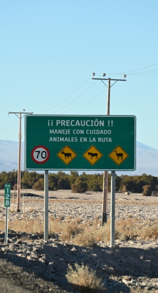
The roads around San Pedro de Atacama are generally in very poor condition. The sun can also be extremely blinding. Watch your speed and make sure you have a quality vehicle with good brakes, excellent tires, and enough clearance to minimize damage when you inevitably hit a pothole.
Health: 4 giraffes ![]() Chile poses few health risks. Hygiene standards are good (meat is kept refrigerated). The water is supposedly safe to drink, but we didn’t see anyone actually drinking it.
Chile poses few health risks. Hygiene standards are good (meat is kept refrigerated). The water is supposedly safe to drink, but we didn’t see anyone actually drinking it.
The risk of mosquito-borne diseases is low: the altitude in Atacama helps with that.
The sun is intense in the Atacama Desert, even in winter. Before heading out on a tour or expedition, make sure to bring a hat, sunglasses, sunscreen, and plenty of water. Lip balm is also recommended — the air is extremely dry. Eye drops can be useful too, either to hydrate your eyes or to flush out any dust that might have gotten in.
Be especially careful about altitude sickness (soroche). It typically occurs above 3,000 meters. Main symptoms include headaches, nausea, vomiting, fatigue, and dizziness. Before heading to high altitudes, drink plenty of water, eat light, and avoid alcohol and coffee. In addition, starting 24 hours before the ascent and throughout our stay at altitude, we took Diamox daily. We had also used it during our trip to Peru and never experienced any issues. However, make sure to consult your doctor before taking any medication.
Gay friendly: 5 giraffes ![]() The rights of the population have made significant progress over the past 15–20 years. Same-sex marriage is legal, as are IVF treatments for lesbian couples and adoption. Several laws also protect the LGBTQ+ community from discrimination, harassment, and violence.
The rights of the population have made significant progress over the past 15–20 years. Same-sex marriage is legal, as are IVF treatments for lesbian couples and adoption. Several laws also protect the LGBTQ+ community from discrimination, harassment, and violence.
Travel ease: 5 giraffes ![]() Chile is a fairly comfortable country. In fact, so far, it’s the easiest South American country we’ve visited.
Chile is a fairly comfortable country. In fact, so far, it’s the easiest South American country we’ve visited.
Highlights: ![]() Easter Island, the Piedras Rojas site, the road to the Salar de Tara in the Atacama Desert, and the Valle de la Luna — all stand out as highlights of the trip.
Easter Island, the Piedras Rojas site, the road to the Salar de Tara in the Atacama Desert, and the Valle de la Luna — all stand out as highlights of the trip.
Letdowns: ![]() The museum on Pinochet’s crimes, where everything is only in Spanish, the high prices of the Atacama Desert sites, and the downright exorbitant cost of the tour to Bolivia — not to mention the fact that you sometimes have to pay in U.S. dollars — all make it feel like a scam is never far away. Whether it’s a tip slipped onto your bill without notice or mysterious fees magically added to the final price of your Bolivia tour, there’s always something.
The museum on Pinochet’s crimes, where everything is only in Spanish, the high prices of the Atacama Desert sites, and the downright exorbitant cost of the tour to Bolivia — not to mention the fact that you sometimes have to pay in U.S. dollars — all make it feel like a scam is never far away. Whether it’s a tip slipped onto your bill without notice or mysterious fees magically added to the final price of your Bolivia tour, there’s always something.
Check out our Travel Reflections articles on Chile:
TWO-WEEK ITINERARY IN CHILE
Here is the detailed itinerary of our two weeks in Chile:
Day 0: We arrive in Santiago after an 11.5-hour flight from Auckland, New Zealand. Crossing the Pacific means we pass the International Date Line. We left New Zealand on July 14 at 7:00 p.m. and landed in Chile at 2:30 p.m. on… July 14! So we get to celebrate Bastille Day twice!


After over an hour in the customs line (always a joy after an overnight flight…), it’s time to head into the city. According to the blogs we read, several fake taxis offer their services just outside the airport. They take tourists for a ride literally before demanding an outrageous fare. Fortunately, there are two more reliable options: official taxis (booked at designated kiosks just before leaving the terminal) or buses. We go with the latter. It’s cheaper, and one of the buses stops at Estación Central, where our hotel is located. The trip takes 30 minutes and goes smoothly.
We decide to pick up some groceries for dinner at the nearby supermarket. The products are fresh, varied, and inexpensive. However, we’re surprised to see armed security guards patrolling the aisles and standing watch near the checkouts. It’s pretty unsettling — it feels like a terrorist attack could happen at any moment.

We head back and have dinner in front of a movie, completely zombified by jet lag. It’s the biggest time difference we’ve faced since the start of our world tour.
Day 1: Still feeling the effects of jet lag, we spend the morning at the hotel. We first set out in search of a Scotiabank — one of the few banks that doesn’t charge withdrawal fees. Almost all Chilean banks charge at least 8 euros per transaction… which can add up quickly.
We then take the metro to the historic district. As soon as we exit, we buy a SIM card at a Movistar store. The company is known for having good coverage and, importantly, it works on Easter Island.
The historic center is fairly busy. Most ground floors of the buildings are occupied by shops, many of them restaurants. Numerous stalls and street vendors sell a wide variety of goods — from the usual hats to the more surprising toilet brushes and climbing ropes.


The buildings are also of rather mixed beauty. Some structures from the Spanish colonial era are colorful and quite charming, while the modern buildings are generally dull and unattractive.
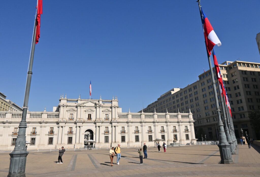
The Plaza de Armas is lined with trees. The surrounding buildings (like the Catedral Metropolitana de Santiago, the central post office, and the national history museum) are imposing and add a touch of charm.


Jet lag starts to catch up with us. We head back to the hotel to rest. That’s it for today.
Day 2: We head out in the late morning and make our way back to the Plaza de Armas. We plan to visit the Chilean Museum of Pre-Columbian Art. As we exit the metro, we find ourselves in the middle of a celebration. It’s July 16 — the Feast of the Virgin of Carmen, a public holiday here.


Dancers in colorful costumes, some even wearing masks, take turns performing to the rhythm of drums and brass bands. The show is vibrant, and the small audience does nothing to dampen the dancers’ spirits.
Once the procession is over, we head to the Pre-Columbian Art Museum. It’s divided into two sections: the Pre-Columbian peoples of Chile in the basement, and those from the rest of the Americas upstairs.


The museum has some stunning pieces, some nearly 2,000 years old. Our favorites are the chemamülles — large wooden statues placed in cemeteries to accompany the souls of the dead — and the many animal- and human-shaped ceramics.


We spend a little over an hour in the museum.
After a very late quick lunch, we head to Santa Lucia Hill. We take a quick look around the craft shop but decide to save our money for Easter Island. We climb to the top of the hill, to the viewpoint, for a panoramic view of Santiago. The city itself isn’t particularly remarkable.

It’s a typical South American city with Spanish influence. Older residential buildings sit next to taller office towers, without much harmony. What saves the view is the beauty of the Andes in the background, with their snow-covered peaks. It’s just a shame that the ever-present smog dulls the light and limits visibility of the mountains. Still, the air is breathable — far from what we experienced in Delhi.
We stop by the supermarket to pick up some supplies for Easter Island. Food is said to be very expensive there, so we’re stocking up in advance. Back at the hotel, we pack our bags while sipping some wine — Chilean, of course.
Day 3 to Day 8: We take advantage of our time in Chile to visit Easter Island. For all the details of our journey, click here.
Day 9: Last day in Santiago. We walk to the Museum of Memory and Human Rights. The museum is dedicated to the crimes committed under the Pinochet regime. It’s free and modern.


However, all the texts are written only in Spanish. Only the descriptions of the items in the display cases and the video excerpts are translated into English. So we’re unable to understand much, especially since we don’t know much about Chilean history. We leave the museum rather quickly, feeling disappointed.
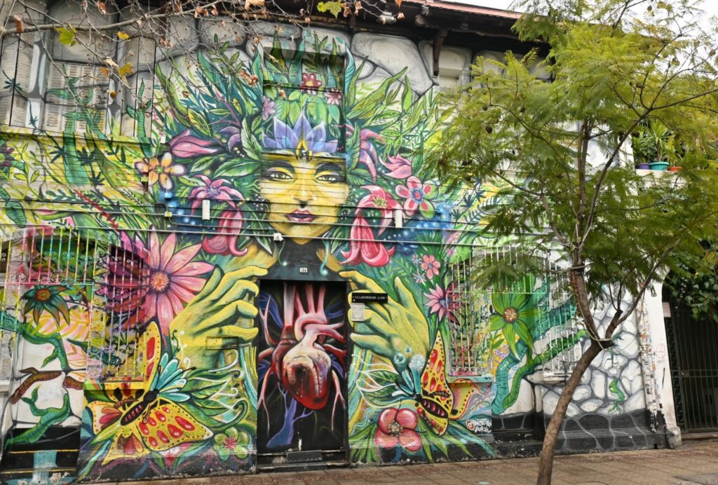
We take the metro to the Bellavista neighborhood. We start with Patio Bellavista, mentioned in several blogs. It’s essentially an open-air dining area: stylish and modern.


We then wander through the surrounding streets. The neighborhood is very colorful, with houses painted in bright shades and plenty of murals. It’s mostly made up of bars, restaurants, and theaters. The atmosphere is likely quite different in the evening — probably livelier than in the middle of the day.


Day 10: A flight of just under two hours takes us to Calama Airport in the north of the country..


When we arrive, we buy our tickets on-site for a shuttle to San Pedro de Atacama. The drive takes an hour, plus another forty minutes to drop everyone off at their hotels, as the driver takes us each to the door.


At the hostel, we’re welcomed with all the warmth of a metal bucket left outside at -40°C… As soon as we drop our bags, we head out for lunch at a nearby restaurant: pesto pasta for Benjamin and braised pork for François. It’s delicious. The portions are huge and inexpensive — we even have leftovers for dinner.

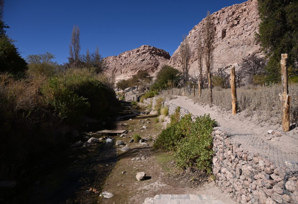
Day 11: We pick up our rental 4×4 in the city center. Since the sky is overcast, we choose a site that’s not too far from town and reasonably priced. So we head toward the Tebenquiche Lagoon. The road is paved for most of the way.


The last quarter of the drive is on a dirt road, which is quite bumpy in places. The site entrance includes access to the lagoon and two sinkholes, located just behind the guard post.


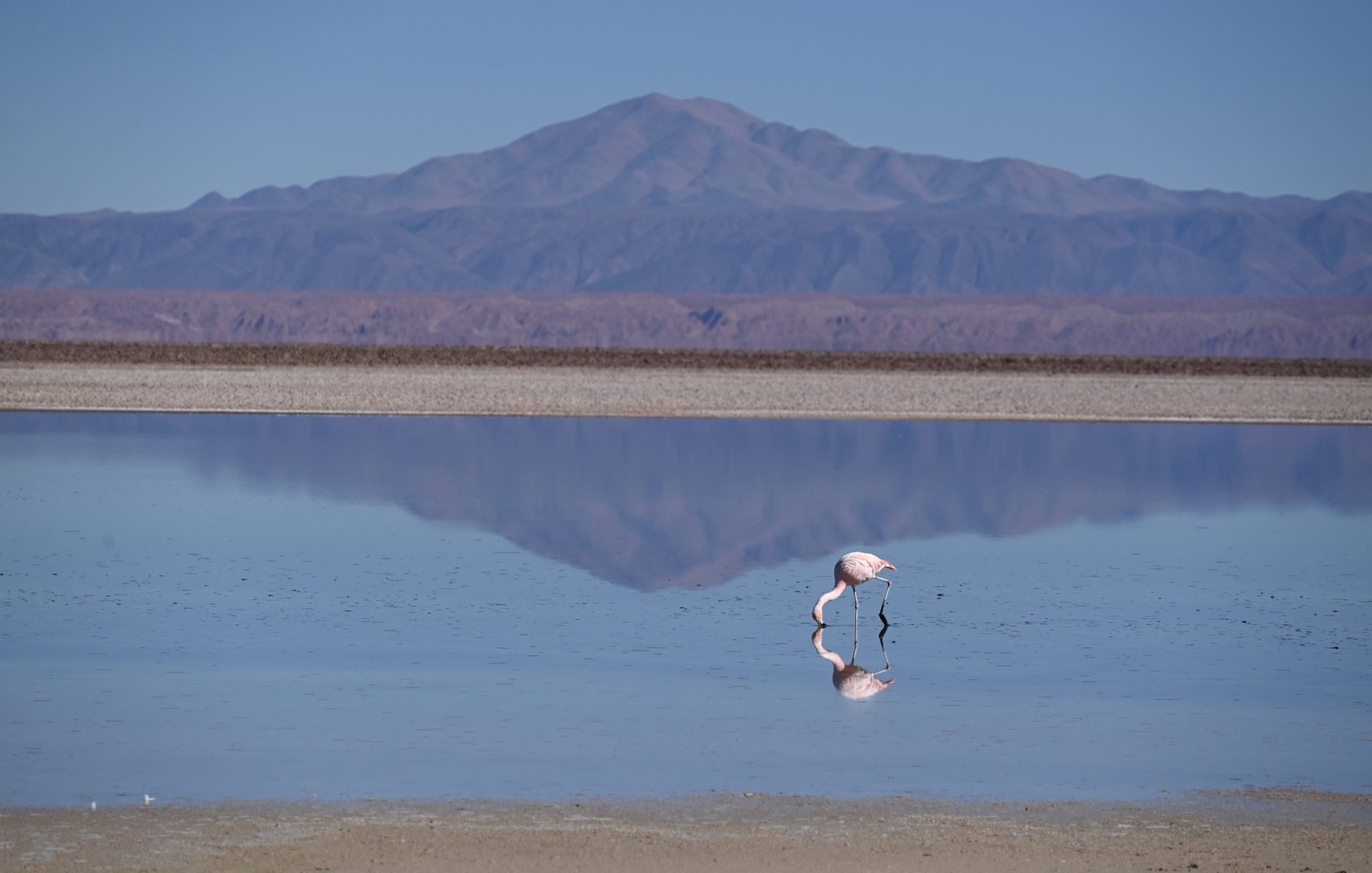
The lagoon is lovely. When we arrive, the absence of wind allows the mountains and clouds to reflect perfectly on the water. A trail also runs along the edge of the lagoon.


At the very end, we come across pink flamingos that add a splash of color to this otherwise monochrome landscape.

We head back to town in the middle of the afternoon to send postcards and check out agencies offering tours that will take us to Bolivia in a few days, the final stop of our world tour.


Day 12: We head to the Chaxa Lagoon, located 40 km from San Pedro.

This lagoon is known for the three species of flamingos that come here to feed: the Chilean flamingo, with pink legs; the Andean flamingo, with yellow legs; and James’s flamingo, with pink legs.

To have a chance of seeing them, blogs and travel guides recommend visiting in the morning or late afternoon — flamingos avoid the heat of the day. So we arrive at the lagoon at 8:30 a.m.… along with several tour groups. We quickly realize that it’s not just the heat or the sun that drives the flamingos away, but the noise from tourists talking and laughing loudly. Before long, the flamingos near the trail take off and settle far off on the horizon, where it’s quiet.


The site is quite beautiful. The ground is covered in salt that crunches underfoot. The volcanoes are reflected in the water of the ponds. It’s a pity that a white haze (dust, maybe?) affects the visibility and dulls the colors.

There isn’t much to do at the site. At the entrance, there are bilingual Spanish-English information panels (a rare sight here) about the formation of the lagoon and the local wildlife. A 1.5-kilometer trail lets you walk across the salt flat. Most tourists stay only about twenty minutes.

We spend five hours there. By late morning, we have the site to ourselves. With the calm restored, the flamingos return and settle near us. We get the chance to take plenty of photos of them in flight or wading in the water. The scenery is much more beautiful with the colorful birds in the foreground.
The entrance to the lagoon also gives access to the Quebrada de Jere. Water from the small Jere River, flowing down from the mountains, irrigates this part of the desert, allowing fruit trees to grow. While seeing greenery and trees at such high altitude in the middle of a salt and rock desert is surprising, the visit itself is rather unremarkable.

Before heading back to San Pedro, we stop in the village of Toconao. We want to see the church, which is a National Heritage site. Its ceiling is made of cactus wood, and it features a rather rare depiction of God with Jesus. The separate white bell tower is also quite charming.


Back in San Pedro, we book our tickets online for Miscanti-Miñiques and Piedras Rojas, which we’ll visit tomorrow. These tickets must be reserved the day before — otherwise, access to the sites is denied. We also buy a cake for François: it’s his birthday!
Day 13: We head south of San Pedro. We have to make a mandatory stop in the town of Socaire (along the way) to pick up the ticket we bought the day before. Without that piece of paper, we won’t be allowed into either site — even with proof of purchase in hand.


Still, the stop turns out to be helpful. The staff member who gives us our ticket recommends starting with Piedras Rojas. There’s less wind (and fewer people) in the morning.
On the way, we cross the Tropic of Capricorn. We can’t resist stopping to take a few photos. We had already done it in Namibia, but it’s not every day you cross a Tropic.

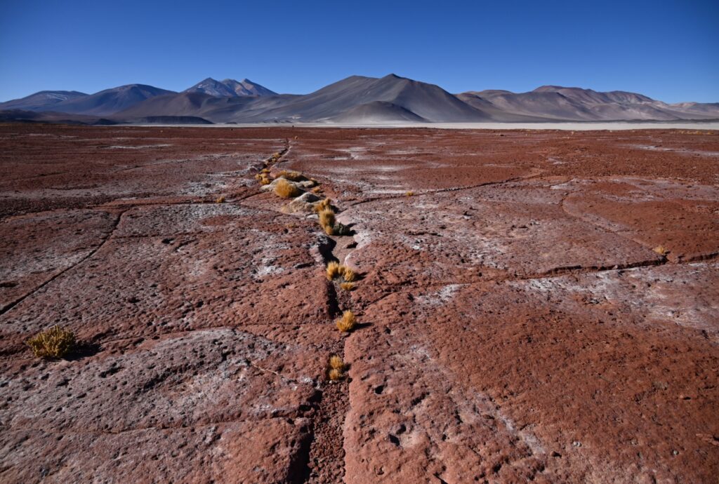
When we arrive, the Piedras Rojas site is almost empty. It’s perfect for taking lots of photos. The place is simply stunning. The massive red rocks are covered in salt. With the snow-covered mountain in the distance and the silence all around, it truly feels like a magical moment.


At the lagoons, the magic fades a bit. Almost the entire visit is done by car. However, once you leave the main road, the path leading to the lagoons is gravel and dirt, a very bumpy ride.
We start with Miscanti Lagoon. The first viewpoint (and the best one, since it’s the only elevated one) is right by the restrooms (!). From there, you get a panoramic view of the lagoon and can clearly see the different shades the water takes on.


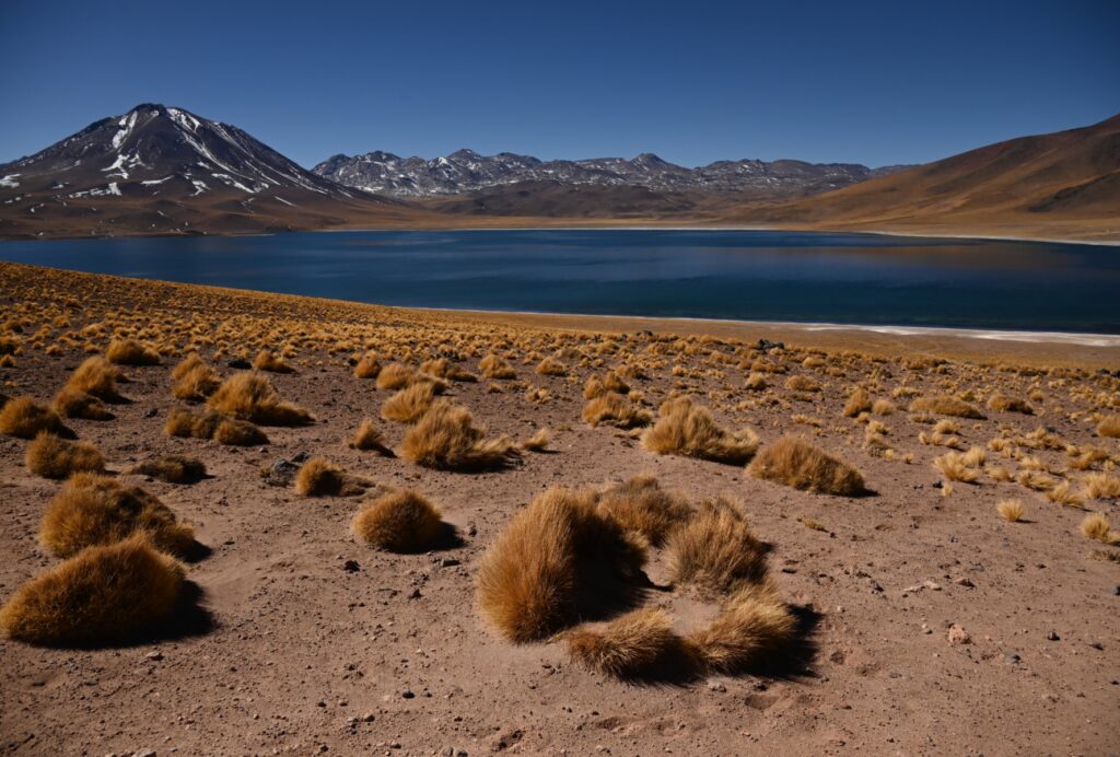
Following the path, you arrive at a parking area at the bottom of the slope, near the water. A short walking trail leads to three other viewpoints. It’s still beautiful, though less impressive than from the top of the hill. You may spot flamingos and vicuñas from there.
We get back in the car to head to Miñiques Lagoon, which is smaller and located just next door.
We find that this one isn’t particularly interesting. The surrounding landscape isn’t especially beautiful, and there are few mountains around. Miñiques is definitely less charming than its big sister. We only stay a few minutes.


We head back to San Pedro, stopping a few times along the way to take photos.
Day 14: We leave early to head toward the Salar de Tara. The salt flat itself is no longer open to visitors: the site was officially closed to protect the environment, and unofficially to allow for lithium extraction (Chile is one of the main producing countries). So we follow the road that leads to the Argentine border. It’s a paved, high-quality road, but it climbs steadily.


In the end, we climb 2,600 meters. While our bodies handle it well, the car struggles a bit with the ascent.
Along the way, several viewpoints (free, for a change!) offer access to stunning landscapes. A true kaleidoscope of colors: the light blue of the sky, the deep blue of the water, the ochre of the mountains, the yellow of the plants, and the white of the snow and ice.


At times, we spot vicuñas and flamingos. We pass through the Quipiaco wetlands, and the salt flats of Aguas Calientes and Quisquiro.

We also follow a guide to the Monjes de la Pacana, rock formations created by lava that was solidified by ice.


It was an exceptional day… and free!
Day 15: We leave at 4:30 a.m., heading for the El Tatio geysers. But before setting off, we literally put on every piece of clothing we have. It’s going to be very cold.
Why so early?
First, because you need to be on-site before sunrise to catch the colder temperatures. The sun’s heat significantly reduces the steam plumes, making the show less impressive. Second, it allows you to arrive before the tour groups, giving you the chance to take photos of an almost empty site. Finally, because the road to get there is in terrible condition. For more than half the drive, you’re bouncing from one “goose nest” to another — considering the size of the holes, calling them potholes doesn’t cut it anymore!
Driving this road with a regular rental car is dangerous. You need a vehicle with good clearance, solid brakes, and excellent suspension. The driver also needs sharp reflexes to avoid ending up in a hole. Luckily, the 4×4 handles it well and François is wide awake. We arrive safely (car included) a few minutes before the site opens, around 6:15 a.m. The thermometer reads -13 degrees. We’re glad we look like two Michelin Men.
The site is divided into two sections. The staff on-site recommends starting with the second section, as the steam columns are the first to fade with the rising sun. We discover a stunning area filled with smoke plumes, some several meters high. Looking more closely, the ground around the geysers is colored in shades of red, green, and yellow. These geysers are nothing like the ones in Iceland — here, most don’t spout much. They mostly release bubbling water just a few centimeters high. Still, the sight is quite impressive.


We have time to explore the site before the tour buses arrive around 7:30 a.m.
We go for a second round, as the steam plumes have grown and the smoke is almost everywhere. It’s really beautiful.


We head to the first site around 8:30 a.m. In the distance, we see the steam plumes from the second site, which have mostly faded. Only a few still rise to any noticeable height most are just thin wisps of smoke.
The first site is much less interesting. It’s smaller and has only a few geysers. There’s a thermal pool where you can bathe (with changing rooms nearby), but it’s closed during our visit. Given the condition of the place, it seems like it hasn’t been used in quite some time.

The only geyser truly worth seeing is the one right next to the parking area. It’s very large and shoots steam more than 10 meters high. The flowing water has emerald tones and is crystal clear. We spend several minutes taking in the spectacle before heading back.
The return is easier in daylight, but no less bumpy. We make a few stops along the way to take photos of the scenery.


We refuse to follow the tour buses into the village of Machuca, as there’s an entrance fee for tourists. That’s pushing it a bit too far!
It takes us about 3 hours to get back down to San Pedro, including breaks.
Important info if you’re planning to visit the geysers: the site is at 4,320 meters above sea level (San Pedro is at 2,450 m). It’s best to be at least somewhat acclimatized to the altitude before going, to avoid altitude sickness. In other words, if you just landed in Santiago the day before, it’s probably not a good idea to start your Atacama trip with El Tatio. Be aware that oxygen is available on-site in case of problems.
Day 16: We head out to the Valle de la Luna, located a few kilometers from San Pedro. We chose to go in the morning since all the agencies in town offer tours in the afternoon. That way, we avoid the crowds of tourists.
The site is 12 kilometers long (one way). It can be explored by car or by bike. Parking areas are available at the entrance to the various points of interest.
The first stop is at Duna Mayor. After a relatively easy climb, you reach a viewpoint overlooking the region. The salt-covered rock formations and black sand dunes are simply stunning. A trail leads to a second viewpoint that offers a different perspective on the landscape also very beautiful.


On the way to the second stop, you pass by “the amphitheater,” the first major landmark of the park. It’s a huge rock shaped like a skateboard ramp. We didn’t really see the appeal and didn’t find anything particularly impressive about it.
The second stop is at the Achaches. After a moderately difficult climb in the sand, you reach the first viewpoint. Two more viewpoints are located further along. However, you’ll need to go down the other side of the dune and then climb up again over rocky terrain to reach them. Expect the full loop to take between 1 and 1.5 hours. The view is definitely worth the effort.


Our third stop is the abandoned salt mine. We recommend parking at the first lot, as it gives quicker access to the site. From there, a trail leads in under 10 minutes to old machinery and deserted shacks. The rocks are also covered in salt, giving the impression of a snow-covered mountain. It’s very beautiful.


The road ends at Tres Marías, a group of rocks meant to represent the Virgin. Originally, there were three, but one was knocked over by a tourist who climbed on it to take a photo. It’s promoted as the second highlight of the site, so you expect something impressive. In reality, it’s quite underwhelming, just two rocks, nothing more.

We noticed that the further you go into the site, the less interesting the spots become. The most beautiful ones are definitely the first.
As mentioned earlier, it’s possible to explore the site by bike. If that’s your plan, we recommend arriving at opening time (cyclists are allowed in 30 minutes before cars). The site’s roads are rough and the sun gets intense quickly. Don’t go to Tres Marías: it’s not worth it. Save your energy for visiting the first few sites.
We return to San Pedro in the early afternoon.


We are going to return the car, do some shopping for the next part of the trip, and go back to pack our bags.
Day 17: It’s already the end of our stay in Chile. We’re leaving early in the morning on an organized tour to go to Bolivia, the final stop of our world tour.
Find all our other articles on Chile:


